Triangulation Calculator
Omni's triangulation calculator will find the coordinates of an unknown point based on two known locations and measuring the bearing either to or from those locations.
You can either:
- Calculate your position by observing two landmarks with known coordinates.
- Calculate the position of an unknown landmark by observing it from two known locations.
If you don't know what triangulation is or the formula for triangulation, worry not! Continue reading this article to know the definition of triangulation and the difference between triangulation and trilateration in surveying. You will also learn how to calculate coordinates using the triangulation calculator.
What is triangulation in surveying? — Triangulation definition
Triangulation, when related to geometry or surveying, is a method of determining the location of an unknown point by forming a triangle or triangles to it from known points.
There are two general types of triangulation:
-
Intersection — You triangulate an unknown landmark by making multiple observations at different locations; and
-
Resection — You determine your own position by observing multiple known landmarks from a single location.
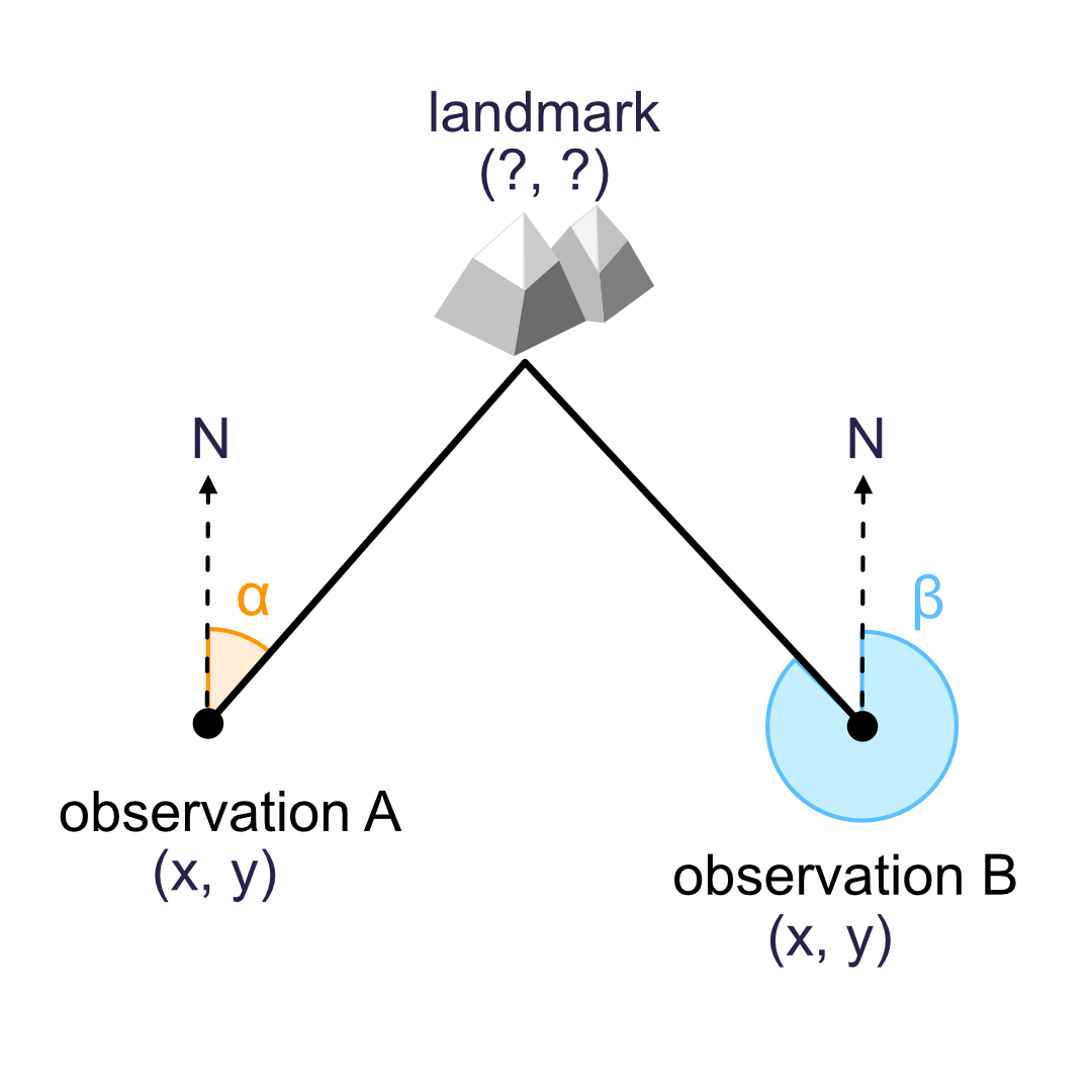
Triangulation formula to find the location of a landmark (intersection)
To determine the triangulation formula for finding the location of a landmark, let us consider figure 1.
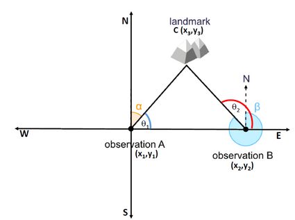
Let and be the two observation points with bearings towards the landmark as and , respectively. If is the location of the landmark, the points , , and form the vertices of a triangle, where:
and
.
Using coordinate geometry, we can write the formula for the slope of line AC as:
Similarly, for line BC, we can write:
To dive into the details of determining the slope in the Cartesian coordinate system, visit our slope calculator.
Solving equations (1) and (2) for and , we get:
and
Triangulation formula to determine your position (resection)
We can also determine the triangulation formula to locate our position with respect to two or more landmark points, as shown in figure 2.
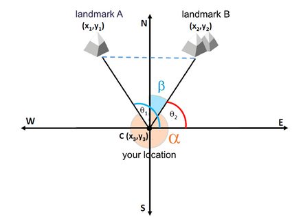
Let and be the two landmark points with bearings as and , respectively. If is our location, the points , , and form the vertices of a triangle, where the angles are:
and
.
We can write the formula for the slope of line AC as:
Similarly, for line BC, we can write:
Solving equations (3) and (4) for and , we get:
and
How to use the triangulation calculator?
Let us see how to use the triangulation calculator to determine the location of a landmark. We will consider A as the reference point for our measurement. Let the coordinates of points and be (0, 0) and (5, 0), respectively. The measured azimuth or bearings at point A and B be and .
-
Using the drop-down menu, select landmark location.
-
Enter the x, y coordinates, and the bearings ( and ) of observation points and in the respective fields.
-
The coordinate triangulation calculator will display the coordinates of the landmark, i.e., (
2.5,4.33). -
You can use our azimuth calculator to determine the azimuth if you know the latitudes and longitudes of the points.
Triangulation vs. trilateration
Both triangulation and trilateration are methods of surveying based on trigonometry. However, while triangulation relies only on angle measurements to locate the unknown point, trilateration uses distance measurements.
Fun fact: While triangulation has an important history in surveying and navigation, GPS uses trilateration to determine your location, not triangulation (the satellites only measure distances)!
FAQ
What is triangulation in land surveying?
In land surveying, triangulation is the method of measuring the angles of a network of triangles. This information is then used to determine distances and relative positions of locations spread over the survey area using trigonometry.
What is the basic principle of triangulation survey?
The principle of the triangulation method is that if the coordinates of two vertices of a triangle (or the length of one of its sides) and its angles are known, we can calculate the coordinates of the third side (or the length of the remaining sides).
What is the difference between triangulation and trilateration in surveying?
The main differences between triangulation and trilateration are:
- Triangulation relies on the measurement of angles. Trilateration relies on the measurement of sides.
- The measuring stations should be mutually visible for the triangulation method. In trilateration, the distances can be measured without the intervisibility of the stations.
What are the applications of triangulation?
Some common applications of the triangulation method are:
- In large-scale land surveying to determine the accurate position of locations.
- In civil engineering projects to accurately locate center line of long bridges and tunnels, etc.
- Land and sea navigation.